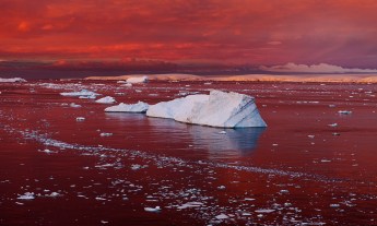
A scary discovery from Arctic ice researcher David Barber — that hints at wild weather to come.
On July 1, David Barber will pack a trunk full of warm clothing and scientific gear and head 1,500 kilometers north, right to the heart of the Arctic. It will be his 35th Arctic field trip. As chief scientist aboard the Amundsen, an icebreaker doubling as a floating laboratory in the Arctic Sea, Barber (TEDxUManitoba Talk: Seven surprising results from the reduction of Arctic Sea ice cover) will be leading a team of 40 researchers to the edge of the polar ice cap to report from the frontlines of climate change.
What are they looking for? Everything that can possibly be measured about the polar ice cap. The Amundsen will launch from Quebec City and head into the Arctic Sea, where the research crew has four months to measure “everything,” Barber says. “I mean, literally, everything. Right from the very bottom of the ocean, up through the water column through the ice, and then right up into the upper part of the atmosphere to the stratosphere.” The Amundsen, which is owned by the Canadian Coast Guard and leased to a publicly funded consortium of Canadian universities, holds $20 million worth of scientific instruments that enable researchers to detect everything from plankton to whale songs, and pollutants to ice thickness.
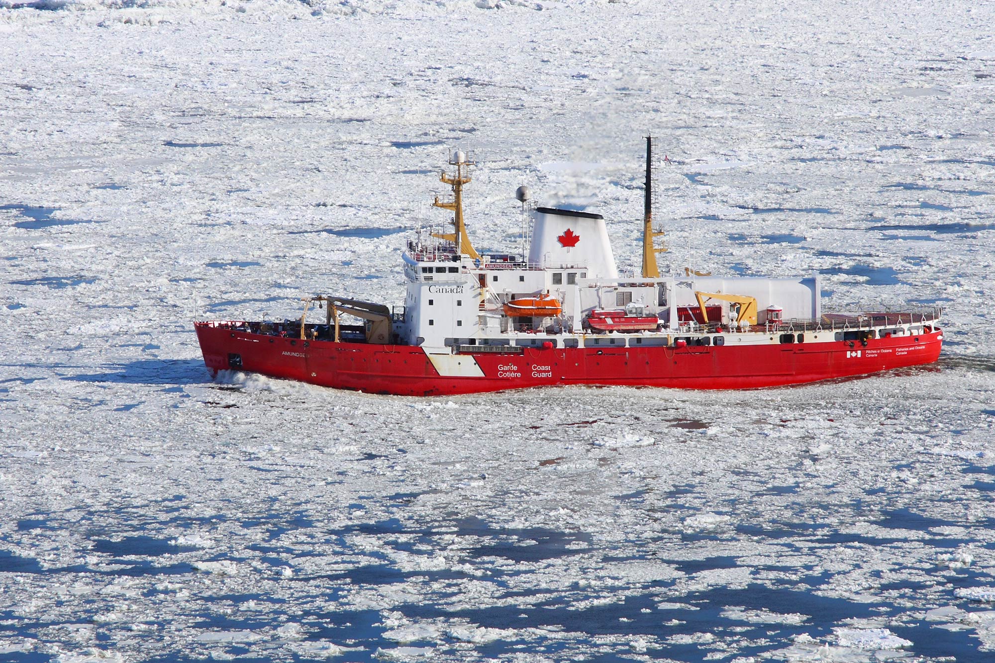 The CCGS Amundsen is a research icebreaker with 22 shipboard labs, designed to give scientists unprecedented access to the Arctic. Photo: Cephas/Simon Pierre Barrette (CC BY-SA).
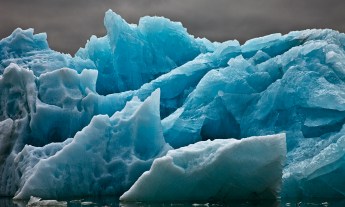
The core of the Arctic ice cap is made up of thick “multi-year” ice. Arctic ice can vary in thickness, ranging from a fragile crust a few centimeters thick to a solid ice floe 40 meters deep. Anything less than two meters tends to melt and break apart during the summer months. Thicker ice, known as “multi-year” ice, forms the enduring core of the polar ice cap. How do Barber and his team find that thicker ice? They can trace its boundaries using satellites and then verify those measurements by carefully navigating the Amundsen up to the edge of multi-year ice packs. “The Arctic basin used to be covered with a lot of this kind of ice,” Barber says.
There’s a deceptive new kind of polar ice — it looks thick and stable from space, but breaks apart before researchers’ eyes. One night during the 2009 expedition, around 3am in the morning, Barber woke up to the strange sensation of the ship moving full speed, 13 knots, through what he thought was an impenetrable expanse of multi-year ice. Satellite images had suggested the area was covered in multi-year ice measuring several meters thick. “Yet I didn’t feel anything on the hull,” Barber says. He rushed to the bridge of the ship and watched as the fog lifted. “We were able to see the ice better. It was just these round, Volkswagen-sized pieces of ice with a thin veneer of first-year ice,” he says. “The satellites thought they were looking at normal multi-year sea ice, but in fact they weren’t. They were looking at a relatively new form of summer ice that we didn’t even know existed.” To figure out just how far this fragile sheet of rotten ice extended, the ship veered east toward the Arctic islands, where multi-year ice normally piles up along the coastlines.
Rotten ice causes misleading measurements — and the ice cap may be a lot less healthy than we think. It was about 500 miles before Barber found what he was looking for: a solid patch of multi-year sea ice. “We pinned the ship to this ice floe,” he says. “We took out big long ropes with posts and we drilled them in and we pulled the ship beside the multiyear floe.” Moments before the teams lowered themselves over the side to begin measuring it close up, the ice began to move. “As we watched, that entire ice floe, which was the size of Manhattan, broke up in less than five minutes.” Waves from a distant storm rolled beneath the ice and broke it into fragments measuring 100 meters across — equivalent to the distance between the swells. Until then, Barber and his team had never seen multi-year Arctic ice in such an advanced state of decay. It’s a phenomenon the researchers dubbed “rotten ice,” and it has encouraged climate scientists to revise their models of where Arctic ice piles up and endures — and revisit some assumptions they made based on satellite images.
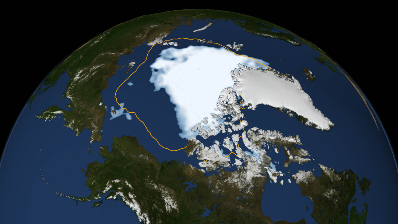 This visualization shows the Arctic ice shrinking in 2012, a new all-time low after its previous recorded low in 2007. Visualization by: NASA Goddard Space Flight Center (CC BY-SA).
On open water, the Arctic doesn’t feel so Arctic anymore. In the last 30 years, the Arctic sea has lost 40 percent of its ice coverage, leaving behind massive expanses of open water in the summer. The dark patches of water absorb heat from the sun, causing Arctic temperatures to rise as high as 50 degrees, and climbing on average two to three times as fast as the average temperatures at lower latitudes. Barber has personally experienced these warm temperatures. “The temperature through the winter was warmer at the ship than it was in Winnipeg during our 2007 over wintering expedition,” he says. As portions of the Arctic grow warmer, Barber says, it can displace the frigid air in other parts of the Arctic — with effects on regional and perhaps even global scales.
US East Coasters, remember last year’s polar vortex? Warmer Arctic air might have played a role. The polar vortex is a circuit of wind that keeps cold Arctic air trapped around the north pole. In the past decade, the circuit has changed its behavior. Why? Several researchers have observed a curious correlation between receding ice and the position of the jet stream. As heat escapes from open water into the atmosphere, the pressure patterns that maintain the polar vortex break down. The jet stream slows down and becomes more loopy, sending lobes of frigid air further south. “You can have cold air outbreaks that can go right down into Florida in the winter,” he says. That frigid air, in turn, can circulate warm air back up along the west coast. “The Arctic connects to the temperate parts of the planet, and may even connect to the tropical parts of our planet, and we’re just beginning to understand how these complex interconnections work.” It’s still a working theory, and climate scientists are still gathering the evidence, which is why it’s essential for researchers to continue their excursions into the Arctic, Barber says.
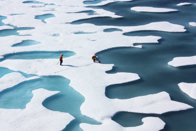
Featured photo: NASA Goddard Space Flight Center (CC BY-SA)


