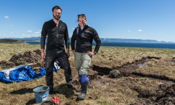
Archaeology is a puzzle. For Sarah Parcak, trying to find ancient treasures is made exponentially easier by satellite imagery.
Archaeologists have many tools at their disposal: shovels, trowels, satellites. If you are scratching your head at that final entry, check out how TED Prize winner Sarah Parcak uses satellite imagery to locate long-lost ancient sites, and to solve some of archaeology’s most enduring mysteries.
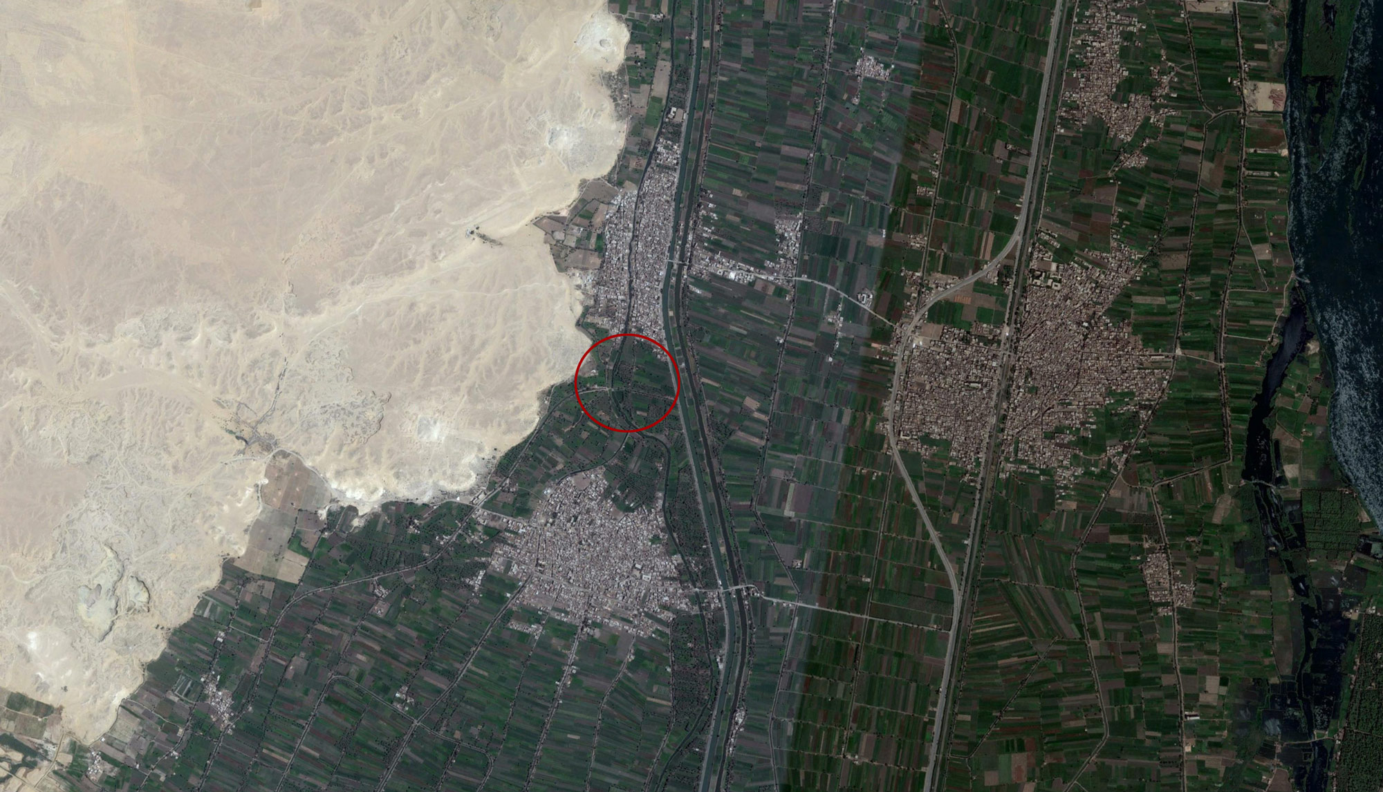
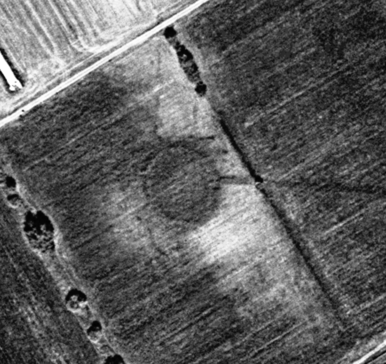
The mystery: What happened to Itj-tawy, the ancient capital of Egypt?
Itj-tawy, once located on the bank of the Nile, was Egypt’s capital for about 350 years during the period known as the Middle Kingdom. But sometime after 1785 BC, when the capital moved to Thebes, Itj-tawy disappeared. “Egyptologists knew the city had to be somewhere near the pyramids of the two kings who built it, but that only narrowed it down to an area about four miles by three miles in size,” says Parcak. To pinpoint the city’s exact location, Parcak’s team used NASA topography data to map the floodplain area, and analyzed it for subtle changes in vegetation. They wanted to understand where the Nile used to flow — to the west of the river we know today. Using the ancient water line as a guide, they spotted a large raised area in the circle above. Parcak collaborated with Egyptian scientists to do “coring” at this site — they drilled out a tube of earth to be analyzed for signs of human life. Under a thick layer of mud, they found a layer of pottery. “It dates to the exact period of Itj-tawy,” says Parcak. Even more interesting — the presence of carnelian, quartz and agate. “These were the most common stones in jewelry from the Middle Kingdom. It’s evidence of an elite jeweler’s workshop,” she says. “It shows that whatever was there was a very important city, likely Itj-tawy.” Image courtesy of DigitalGlobe.
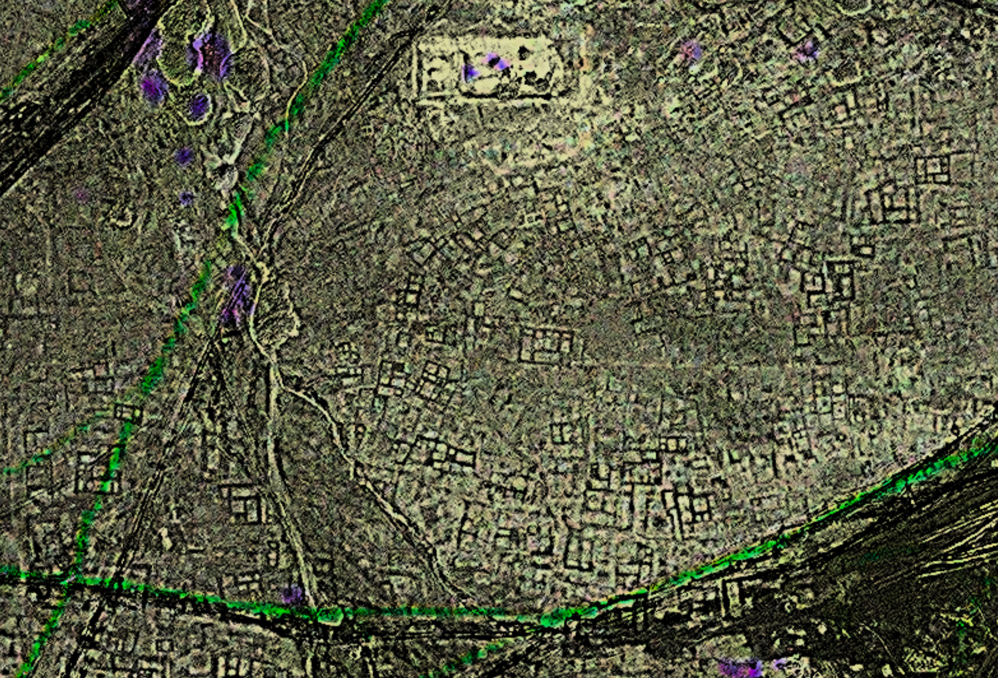
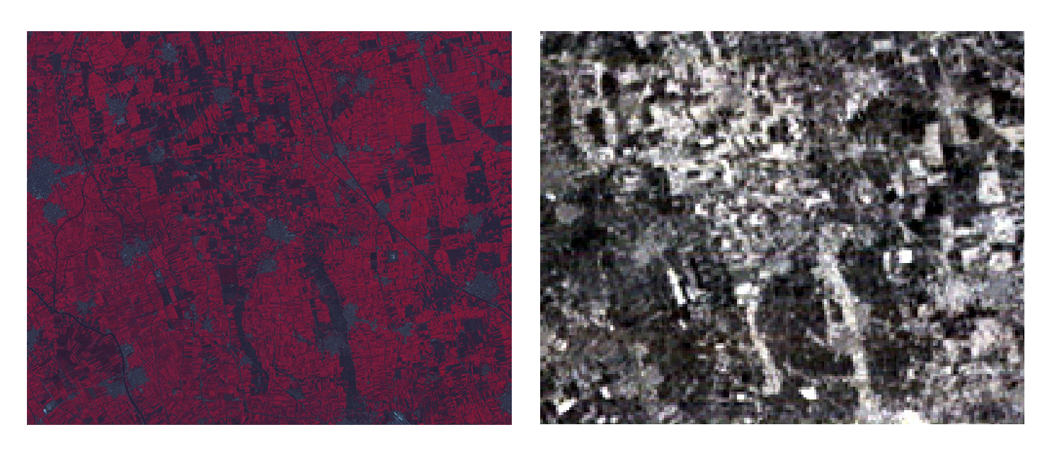
The mystery: What did the lost city of Tanis look like?
Archaeologists have explored the tombs and temples of Tanis since the mid-1800s. In 1939, Pierre Montet discovered the intact tomb of Pharaoh Psusennes I, the “Silver Pharaoh,” as well as the tombs of many of his descendants. Even if the Silver Pharaoh isn’t as famous as King Tut, he has long fascinated Parcak. “Gold was a lot more common than people think in ancient Egypt,” she says, “but silver was incredibly rare. The pharaohs of Tanis had coffins of silver, which shows you how wealthy they really were.” Parcak wanted to pinpoint and map the city these pharaohs built. So, in 2011, her team turned to satellite imagery of the area where they suspected the city had to be. “We used multi-spectral imagery analysis and merged it with high-resolution imagery, then used enhancement techniques to get the buildings to really pop out,” says Parcak. In the image above, the ancient city begins to be visible, the black ancient buildings standing out against the lighter earth covering it. With further analysis, her team could see the shape and size of the city, as well as the types of buildings in it, and could make educated guesses about the class system of the city’s people. They will publish their map and findings soon. Image courtesy of DigitalGlobe.
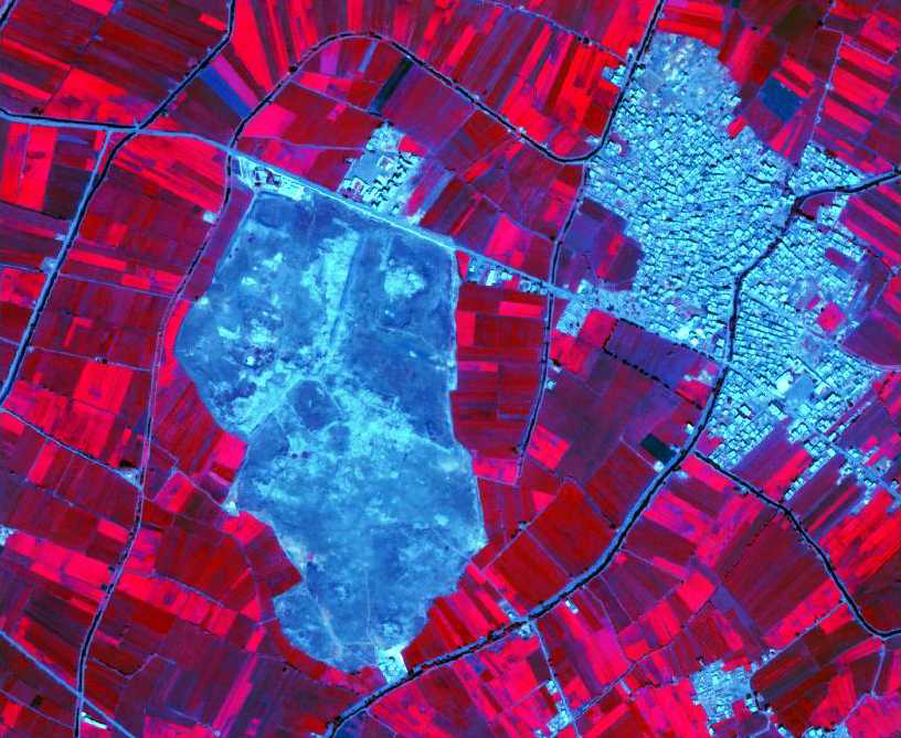
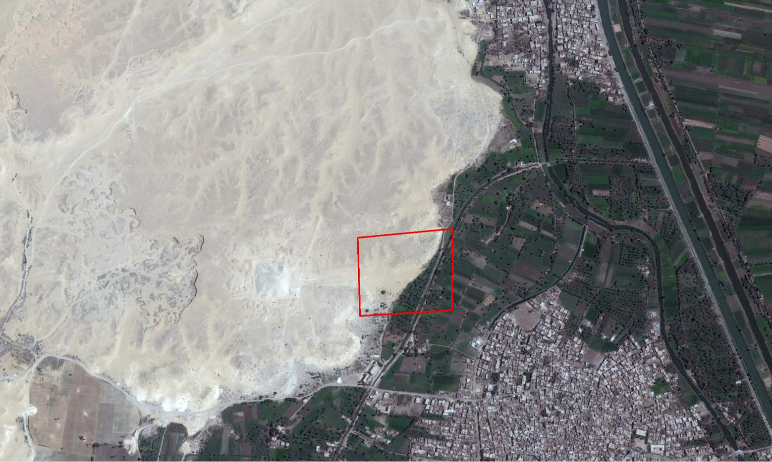
The mystery: Why has looting in Egypt accelerated so much in recent years?
Parcak’s team used open-source satellite data to map looting across Egypt from 2002 to 2013. They found looting at nearly 300 sites, and more than 250,000 individual spots and holes where they could see that looters had dug up earth. The team could even see how the patterns of these so-called “looting pits” changed over time. “The question I don’t think enough people ask is: when did this start?” says Parcak. “People seem to think it began in early 2011, in response to the Arab Spring.” But looting actually shot up in 2009. Parcak points to this image of Athribis, a Greco-Roman site north of Cairo. In 2007, the site showed no signs of looting, but in this image from 2009, looting pits cluster near the modern, rectangular building. “Looting picked up on the heels of the global recession,” says Parcak. “Looting is fundamentally an economic issue. Most of us would loot if our families depended on it; it speaks to a lack of opportunities.” To understand further, Parcak and her team analyzed satellite data for three specific Egyptian sites between 2009 and 2013 — and in that time, saw a 500% increase in looting. Image courtesy of DigitalGlobe.
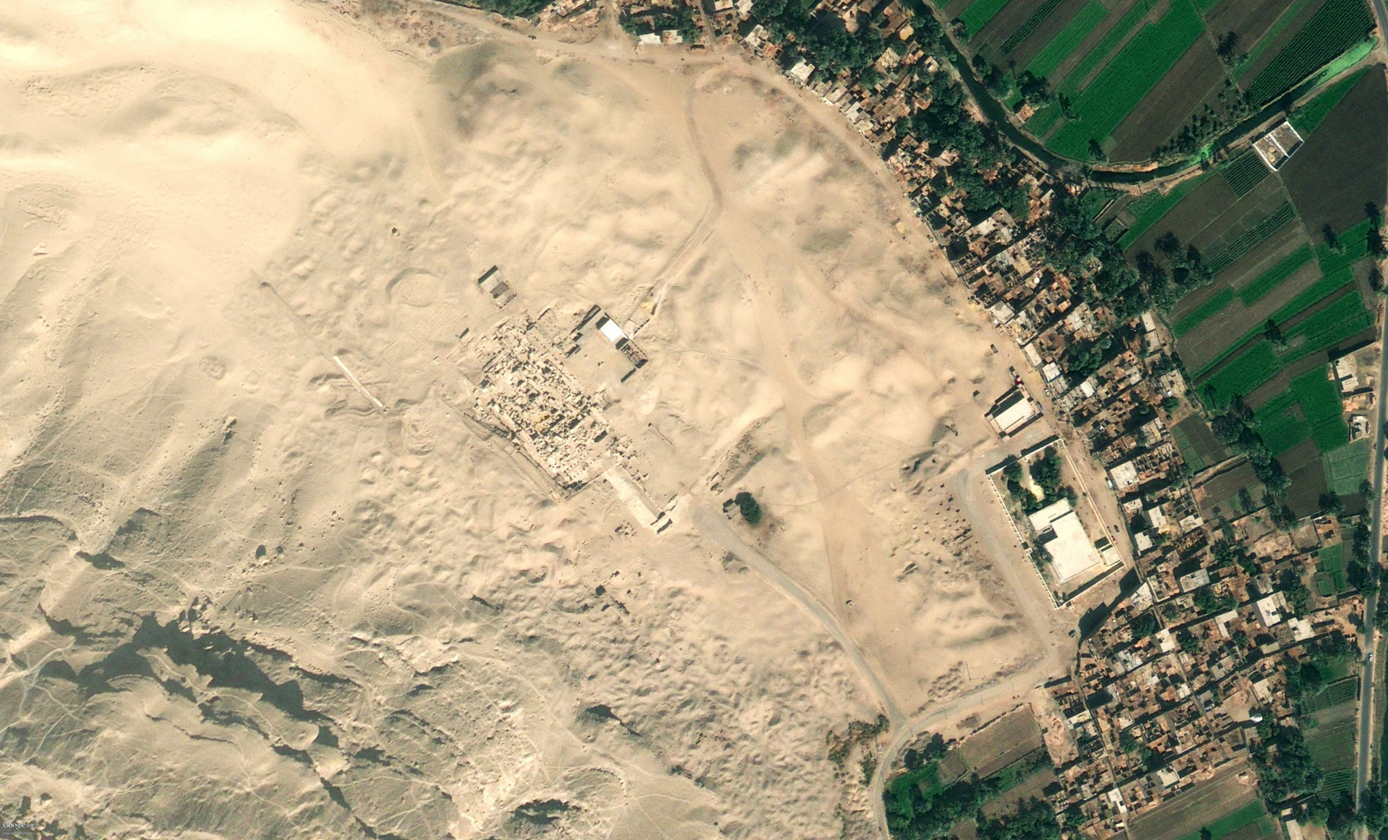
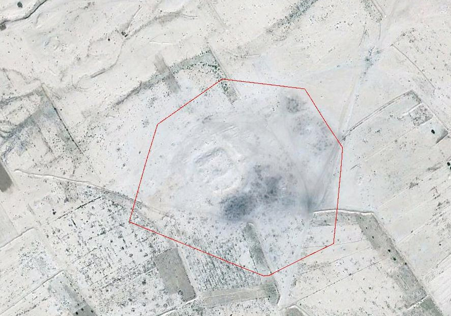
The mystery: Where is the lost Amphitheatre of Portus?
“Portus was kind of like the Roman Empire’s Amazon.com,” says Parcak. This ancient city on the Italian coast was a center of commerce and trading. Parcak teamed up with colleagues who’d been studying the remains of the ancient city for 30 years to survey it by satellite for the first time. “I worked for weeks in my lab, and found nothing new,” says Parcak. “At one point, I thought I found all these amazing houses and warehouses, but they knew about them already.” A breakthrough came with satellite data from the fields to the northeast of the modern city of Porto. “An interesting feature showed up — about 40 meters across, with 8 meter thick walls. It had clear roadways and gates,” says Parcak. “When I showed it to my colleagues, they got excited. They told me I had likely found the missing Amphitheatre of Portus. They had been trying to find it for decades.” The moment underscored to Parcak just how much is left to find at even the most well-explored sites. Image courtesy of DigitalGlobe.
The mystery: What remains to be discovered in the Valley of the Kings?
The Valley of the Kings in Egypt is another well-studied archaeological site — it’s the site of King Tut’s tomb. But here too, undiscovered features abound. In late 2015, radar scanning of Tut’s tomb confirmed the existence of two previously unknown doorways. To Parcak, this highlights the need to rescan sites as technology develops. “I’m interested in using thermal infrared to see heat signatures in the valley,” she says. The Valley of the Kings functions like a suntrap, heating up throughout the day. But empty pockets stay nice and cool. As air escapes them, it lowers the temperature of the rock above. Satellite imagery can note those subtle temperature differences, and show us where unexplored chambers might be located. The two images above show NASA satellite imagery of a part of the valley — the image on the left is unprocessed, while the image on the right has gone through thermal infrared processing. Because of the processing, rooms and chambers glow bright white. This type of analysis helped Parcak and her husband locate several unknown features — including a cluster of huts and a Coptic monastery. “We can re-approach old sites in new and innovative ways,” says Parcak. Image courtesy of DigitalGlobe.
The mystery: How do you train a computer to spot archaeological features?
This image shows the Egyptian city of Mendes, also extremely well-studied. It’s the first place where Parcak worked as an undergraduate student in 1999, and the site where she later piloted her techniques for analyzing satellite imagery. “I had a good sense of all of the known archaeological sites in the area,” she says, “so I tried a range of things to see what made archaeological sites stand out as distinct.” Parcak refined an algorithm to sort satellite image pixels by the chemical signature of the soil below. In this image, soil that contains traces of archaeological material appears blue while crop soil appears red. Once Parcak had a 95% success rate in detecting known sites, she started looking for features not yet in archaeological databases. Image courtesy of DigitalGlobe.
The mystery: What makes this Roman fort in Tunisia special?
Parcak spotted this fort — the raised area circled in red above — while mapping ancient Roman roads in Tunisia with a colleague. “When people hear about Roman road networks in North Africa, they imagine a long, continuous system. But that wasn’t the case,” says Parcak. Given the vast expanse of the continent, the Romans had to be strategic about the way they guarded it, and so built forts every 200 kilometers or so to make sure no one came or went without paying taxes. “Forts are a revenue generator,” says Parcak. But this one looked especially interesting from the air — it has dense, dark smudges to its southwest. “It looked charred,” says Parcak. “I couldn’t explain it — until I got there. At that part of the site, we found slag, an industrial byproduct. It shows this site was a pottery production center.” Why would that be? Well, says Parcak, because “if you have all these forts within a day’s distance of each other, you need a place to make pottery to hold the wine and carry the goods.” Image courtesy of DigitalGlobe.
The mystery: Who is buried in this 3,800-year-old tomb?
The site of el-Lisht in Egypt, located south of Cairo, also dates back to the Middle Kingdom. Seen from space today, el-Lisht is speckled with looting pits. When Parcak arrived for a dig there, the crew was concerned that looters would return and pointed Parcak toward a large tomb they wanted to examine before it was too late. Soon, the team began finding exciting pieces like painted reliefs and fragments of inscriptions. “I began to have hope that we’d find the name of the tomb owner,” she says. For ancient Egyptians, this was the point of a tomb: to make their name last for eternity. After finding the tomb owner’s assorted titles — Overseer of the Treasury, Overseer of the Army — they finally found his name in hieroglyphs: Intef. Parcak describes this as “the most incredible moment of my career.” Because, in the end, she says, “When we dig, we are digging for people, not things.” Image courtesy of DigitalGlobe.
With the 2016 TED Prize, Sarah Parcak has built a citizen science platform for archaeology, called GlobalXplorer.org, that invites the world to help locate and protect ancient sites. DigitalGlobe has provided satellite imagery; National Geographic Society has contributed rich content and exploration support; and you’ll provide the analytical power.