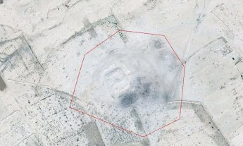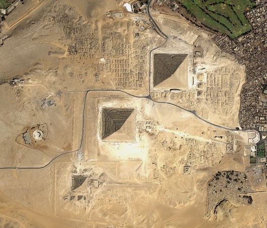
Strange as it may seem, archaeologists often look to the sky to discover sites buried deep beneath the earth. Space archaeology, as it’s called, refers to the use of high-resolution satellite imaging and lasers to map and model everything from hidden Mayan ruins in Central America to specific features on the ancient Silk Road trade route in Central Asia. The process saves research teams years it would have taken to do the same work using ground-based survey techniques.
Archaeologist, Egyptologist, University of Alabama at Birmingham professor, TED Fellow and 2016 TED Prize winner Sarah Parcak makes extensive use of this technology in her work, and she has done much to popularize space archaeology. She wrote the world’s first overview book on the subject, and gave a talk at TED2012 to explain how borrowing the tools of space exploration helped her identify an ancient Egyptian city that had been hidden for thousands of years. Here, she tells us more about how it all works — and how she applies it to her on-the-ground explorations.
How long has space archaeology been around? Who figured out that this could work?
Archaeologists have used aerial photographs to map archaeological sites since the 1920s, while the use of infrared photography started in the 1960s, and satellite imagery was first used in the 1970s. But it wasn’t until a seminal conference held at NASA in 1984 by my friend Dr. Tom Sever, whom I call the father of space archaeology, that we started to see more peer-reviewed papers on the topic. Tom introduced the field to a number of influential archaeologists — and then things really started developing when those archaeologists trained their graduate students, and those students started getting positions ten years ago.
Today, space archaeology is fairly standard practice. Conventional excavation and survey are crucial to confirm any satellite imagery findings, but analyzing the images saves time and money and allows projects to focus on specific locations at archaeological sites.
How do these technologies help to identify objects buried in the ground?
The only technology that can “see” beneath the ground is radar imagery. But satellite imagery also allows scientists to map short- and long-term changes to the Earth’s surface. Buried archaeological remains affect the overlying vegetation, soils and even water in different ways, depending on the landscapes you’re examining. So, for example, buried features in desert environments appear different from buried features in floodplains. When a wall is slowly covered over by earth, the materials it’s made from decay and become part of the soils around and above it, sometimes causing vegetation above and next to the wall to grow faster or slower. Satellite imagery helps archaeologists to pick up these subtle changes.
If you find a series of linear shapes in the same alignment as known archaeological features, and they match excavated examples, you still need to excavate to confirm, but you can be fairly sure that the imagery is accurate. Often discrepancies are much more readily apparent in the infrared part of the light spectrum, since vegetation and other changes to soils appear more strongly in infrared.

You’ve been working in Egypt recently. How does the process of using satellite imaging work in practice? Do you get satellite maps sent to Alabama, from where you plan excavations?
We do extensive background research on what is known or has already been excavated or surveyed in each area to create a comparative dataset. We then look at previous work (if we have not done any) to determine what season might be best for ordering imagery. Seasonality is a huge factor, as some sites appear in rainy seasons and are invisible during dry seasons, and vice versa.
We then check databases from NASA and DigitalGlobe, which is the largest provider of high-resolution satellite imagery in the world (hopefully they have data from the right location at the right time of year!). We use the data to create a Geographic Information System (GIS) — a layered database for all of our imagery and archaeological data. Then, and only then, do we begin to process the data. Once we’ve analyzed the satellite imagery, we look at the potential sites and features we’ve discovered, and begin to plan our fieldwork.
Why is satellite archaeology especially useful in Egypt?
The state of preservation beneath the sand is excellent, and the soil and geological makeup of archaeological sites in the floodplain are conducive to satellite remote sensing. The imagery can detect entire sites or features — many of which can be hidden by cultivation or partial urbanization. We were able to map the entire city of Tanis using high-resolution satellite imagery, and we are beginning to map other sites as well.
What’s been your most spectacular find using this technology?
I don’t think there is one single thing I’ve found that I consider spectacular. But what I do think is amazing is that the imagery analysis has shown us that we only know about a tiny fraction of sites and features in ancient Egypt. Think about all of the huge questions we have not been able to ask due to a dearth of data: about the rise and collapse of ancient Egypt or how and why the Nile River changed over time. Our entire picture of ancient Egypt will be totally different in 25 years.
Have the two industries “borrowed” from one another? In other words, have any aspects of archaeology made their way back into space or satellite technology?
I think we are small potatoes compared to the military needs for satellites. I will say this, though: without archaeologists taking aerial photos of sites during military reconnaissance in WWI, the field of remote sensing wouldn’t have developed as quickly. Archaeologists gave the military the idea to use aerial photographs for spying and field survey. We are fortunate that the spatial and spectral resolutions of the imagery available to us are so broadly useful for archaeology.
Why is the combination of space and archaeology so very seductive?
I think it appeals to two basic interests nearly everyone has: space exploration and archaeology. Put them together and people’s minds start to wander — in a good way! I also think people are already so captivated with ancient Egypt that the idea that only a fraction of its sites have been discovered from space is just mind-blowing.

“Questions Worth Asking” is a new TED editorial series; this week we asked the question, “Can I borrow that?” to dig into themes of cross-disciplinary innovation and idea-sharing. See also Seth Godin’s op ed, “Why I want you to steal my ideas,” a story about SkyBox Imaging, a company using unexpected technology to build a new type of satellite, and an interview with Suzanne Lee, who’s mixing science, fashion and kombucha to extraordinary effect.


