
Earth has been around for over 4.5 billion years, and modern humans have inhabited it for the past 200,000. Yet in all that time, we’ve learned surprisingly little about the planet’s landscape and the animals that live on it. This is especially true of remote areas such as the Amazon’s dense jungles, the ocean’s vast coral reefs or the wide-open desert of Mongolia.
For scientists who want to study these ecosystems — and for conservationists trying to save them — finding and mapping the regions are the first vital steps, as you can’t analyze or protect what you can’t see. Increasingly, scientists are using drones and other aerial technology to give them a new view.
In his TED Talk, Ecology from the air, Greg Asner shares the surprising insights into animal behavior and the changing environment that he gathers from the air. A scientist at the Carnegie Institution for Science in Washington, DC, Asner has developed the Airborne Taxonomic Mapping System, or AToMS, a set of sensors that attach to the belly of a Dornier 228 aircraft. AToMS can scan 150,000 hectares of remote terrain a day.
AToMS includes an infrared LiDAR, a laser that measures distance by zapping a surface with light and grabbing its reflection up to 500,000 times a second; an imaging spectrometer, which can scope out the chemical composition of leaves; and a zoom lens to identify individual leaves’ shape and orientation. Computers crunch the resulting data into gorgeous, colorful three-dimensional maps.
Asner and his colleagues are now mapping the biodiversity and biomass of the western Amazon basin. They are also tracking charismatic species — such as lions, elephants and rhinos — in South Africa’s Kruger National Park to help with population management. At the same time, they are providing data to developing countries to help reduce deforestation and trade carbon credits under the Kyoto Protocol.
Asner says that the goal is not just to see what’s going on in these regions now, but also to create a baseline. A map of the Amazon basin, for example, is a reference for how climate change alters the rainforest over time. The data can also reveal activities that endanger an ecosystem; in the Amazon research, an algorithm that removes the trees from the 3-D map to show the land beneath has revealed illegal gold mines.

“Everything we do is designed to improve conservation, management and resource policy,” Asner said. “The tech isn’t the goal, but the means to address these challenges.”
He isn’t keeping the tech to himself. Asner wants to spread his techniques and software to researchers all over the world. So far, 300 groups — including NGOs, governments, and academics — are working with his system in one form or another. By the end of the year, his team will also release a training course via CLASlite, a software program to monitor forests that pulls data from satellite images.
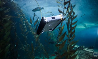
In another talk, A drone’s eye view of conservation, Lian Pin Koh — who is the co-founder of ConservationDrones.org — shared a similar, but rather low-fi, approach to tracking wildlife and monitoring forests. In his environmental work, he uses unmanned aerial vehicles. These drones — essentially self-piloting toy airplanes — carry small payloads including cameras, video and thermal sensors.
In 2012, Koh and his partner, Serge Wich, ran their first pilot program in Sumatra, Indonesia. There, they surveyed critically endangered orangutans. In the past, researchers had to trudge deep into the jungle to count the apes, which is pricey, time-consuming and dangerous. Such counts are also hard to get right, as orangutans build nests high in the forest canopy and are difficult to spot.
Koh’s team launched their cheap, lightweight drones to take images of the nests from above, and Koh is working with computer scientists to automatically tally the orangutans captured in thousands of photographs. He hopes this will provide a more accurate count, which can help conservation groups understand precisely what they’re dealing with.
“The last orangutan survey conducted for the island of Sumatra [using traditional methods] took four whole years and cost around $250,000,” Koh told us by email, as he traveled back to Sumatra to continue the project. “We believe conservation drones can be a much more cost-effective method for orangutan surveys.”
Like Asner, Koh also has an open approach to his work, and has worked with over a dozen conservation groups, including the World Wildlife Fund in Nepal. As Koh describes in his talk, he is training Nepalese conservationists to monitor wildlife in the diverse Himalayan foothills, home to one-horned rhinos, Asian elephants and Bengal tigers. Such animals are highly prized on the black market. Koh’s drones may help rangers to scan thousands of hectares of national park to identify and flush out poachers, as well as to monitor forest growth and deforestation due to metastasizing palm oil plantations or illegal logging.
Of course, Asner and Koh aren’t the only scientists seeking the planet’s most remote regions from the sky.
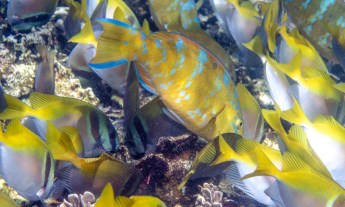
Sam Purkis, a marine biologist at Nova Southeastern Oceanographic Institution, maps coral reefs to monitor their health using both satellite data and an airplane outfitted with a visible light laser and special cameras. These devices are able to penetrate the water to map seafloor topography and identify different habitats. Purkis identifies coral reefs that are unhealthy to help nations with conservation.
Trae Menard, the director of forest conservation for the Nature Conservancy in Hawaii, and colleagues from Resource Mapping Hawaii, map invasive plants that threaten to choke the watershed in the remote Kaua’i mountains. The team uses planes and helicopters outfitted with gyro-stabilized cameras. Proprietary software developed to detect IEDs now helps stitch the images together to reveal the location and shape of invasive plants such as the Australian tree fern. Later, the team flies over the area in a helicopter to track and kill said species with targeted pesticides.
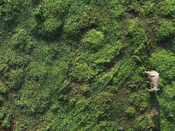
A similar technique is in use by Dana Slaymaker from the original Resource Mapping group in Massachusetts. He’s spent 20 years working with conservation groups to monitor flora and fauna worldwide. His latest work maps populations of wild asses, camels, and gazelles across the Gobi Desert in Mongolia, which his team can identify by the unique shadows they cast on the desert sands. The project aims to map the animals’ locations so that a planned copper mine and access road will have minimal ecological impact.
Christopher Zappa and colleagues from the Lamont-Doherty Earth Observatory at Columbia have developed IcePod, which measures ice sheets to see how they change over time. IcePod includes infrared imaging systems to measure surface temperature, photographic aerial maps and LiDAR to look at ice topography, and deep ice radar to measure ice thickness. The instruments are attached to the outside of a Lockheed LC-130 — a ski-equipped plane that travels to science bases in places like Greenland. Zappa shrunk IcePod’s tech to fit on small drones, too, which can launch from land or a ship to map ice formations that would otherwise be unreachable.
As Lian Pin Koh’s work shows, expensive, high-tech equipment isn’t the only way to get good images from the sky. Ned Horning from the Center for Biodiversity and Conservation at the American Museum of Natural History has tinkered with helium-filled weather balloons and hobbyist kites outfitted with off-the-shelf digital cameras to map wetlands near the border of Canada and sea turtles off the Palmyra Atoll in the South Pacific.
And this is just the beginning. Drones, for example, are just starting to be taken seriously as scientific tools — previously, they were considered to be military equipment or high-tech toys. “People are just starting to use them for real science,” Zappa said. “Up until now, they were more of a ‘gee-whiz’ thing.”
Brooke Borel is a regular contributor to TED.